Las Vegas Valley faces wind gusts and showers before dry weekend
Gusts of 30 to 40 mph will affect Friday evening commutes, while measurable rain is forecast to return later in the week.
By Mariam Saleh ·
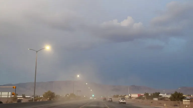
Wind gusts between 30 and 40 mph will sweep across the Las Vegas Valley through Friday evening, impacting the commute home. Scattered showers will accompany the breezy conditions, though rain is not expected to be widespread. Temperatures will peak in the low 70s during the afternoon before falling into the 50s overnight.
Drivers are advised to secure loose outdoor items and exercise caution on elevated roadways where wind speeds are strongest. The unsettled weather will persist through Friday night before conditions improve for the weekend.
Saturday will bring clearing skies after a few lingering showers possible early in the morning, mainly over Eastern Clark County. A north breeze will accompany sunshine, with a high of 69 degrees and a low of 50 degrees. Sunday will be dry and partly cloudy, starting cool in the upper 40s and reaching a high of 68 degrees.
A stronger storm system will arrive Monday afternoon, bringing more widespread rain chances and cooler air. KVVU forecasters label Monday and Tuesday as First Alert Weather Days due to the expected measurable rainfall, particularly in northern areas. Monday will top out at 67 degrees, while Tuesday will cool to a high of 61 degrees.
A brief break in the rain is expected Wednesday, with temperatures dropping to a low of 44 degrees. However, another system will approach Thursday and Friday, bringing the season's coolest air. These days are also designated as First Alert Weather Days, with highs of 59 and 57 degrees respectively.
Residents are encouraged to monitor the changing conditions via the FOX5 First Alert Weather App.
More News · Henderson news · Report a business · Got a Story?